Authority
Boundary, easement, utility, road, permit, and owner authorization.
Selective brush removal, lower-canopy opening, and corridor planning for mountain, lake, field, road, and solar views.
Estimate clearing cost↗Checked 2026-09-01
Selective brush removal, lower-canopy opening, and corridor planning for mountain, lake, field, road, and solar views. Mulching head for the understory, hand and climbing work for the selective removals and lifts, handling Selective by definition — the question is which stems, not how big. A planning range of 0.2–0.6 acres per day covers most projects — view work is the slowest per acre of any scope here because almost every stem is a decision. Production is set by how carefully the corridor is marked, not by the density of what is in it. The best window is mark the corridor with leaves ON, in the season you most want the view, because that is when the vegetation is actually blocking it. Cut in winter. It finishes a sightline opened along a corridor drawn from the actual viewing point, but not a clearcut. Removing everything usually produces a worse view and a worse property. — those are separate, separately-priced scopes.
A good view-clearing plan is drawn from the viewing point. Flag the target corridor, retain framing vegetation, consider seasonal leaf cover, and avoid clearing a wider swath than needed.
Shoreland, steep-slope, municipal, HOA, habitat, and utility rules may apply. Arborist work is separate where retained trees need climbing, pruning, or technical removal.
Best window: Mark the corridor with leaves ON, in the season you most want the view, because that is when the vegetation is actually blocking it. Cut in winter.
Avoid: Marking in winter and cutting in winter. A corridor flagged with bare branches is always wider than it needed to be once the leaves return.
| Factor | What it does to the job |
|---|---|
| Corridor precision | A tightly marked corridor is slower per acre and far cheaper overall than an open instruction. |
| Tree work | Any removal needing a climber or a crane is a separate, larger cost. |
| Shoreland or ridgeline rules | Where they apply they can cap how much cleared area is permitted at all. |
| Slope | The best views are usually on the steepest ground. |
| Debris | On a view property the owner usually cares what the ground looks like afterwards. |
| Included in this scope | Status |
|---|---|
| A sightline opened along a corridor drawn from the actual viewing point | Finished by this scope |
| Framing vegetation deliberately retained so the view has edges | Finished by this scope |
| Lower canopy lifted where that opens the view without removing the tree | Finished by this scope |
| A line that can be maintained rather than reopened from scratch every five years | Finished by this scope |
| A clearcut. Removing everything usually produces a worse view and a worse property. | NOT finished — price separately |
| Technical tree removal, which is arborist work | NOT finished — price separately |
| Permission — shoreland, ridgeline and association rules bite hardest exactly here | NOT finished — price separately |
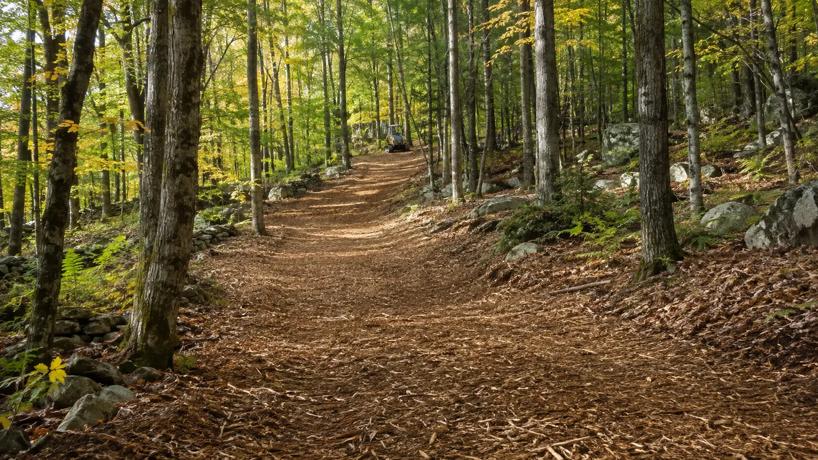
Stand at the exact spot you will look from — the chair, the deck, the kitchen window — and photograph the view as it is. Everything gets marked from there, not from outside.
The expensive mistake: Clearing to the view instead of to a corridor. The wide cut gets the view and loses the privacy, the wind break, the wildlife screening and, on a shoreland parcel, possibly the permit.
Doing it yourself: Standing at the window with a helper and a roll of flagging tape is the single highest-value hour on this whole scope, and only the owner can do it — nobody else knows what you want to see.
Afterwards: Views close in from below. The maintenance is an understory pass every few years, which is cheap; letting it go for fifteen years and starting again is not.

Flag the exact corridor, retained vegetation, utilities, walls, fences, structures, downhill exposure, and the width needed for future maintenance.
Old wire, posts, rock, overhead limbs, uncertain boundaries, and public-road authority must be resolved before high-speed production.
For selective view & vista clearing, write what stays, what goes, how material is handled, where machines may travel, and what the land should support next.
Boundary, easement, utility, road, permit, and owner authorization.
Vegetation, stem size, rock, wetness, debris, grade, and stable access.
Mulch, mow, cut, chip, fell, excavate, haul, or use a sequenced mix.
Finish tolerance, material location, restoration, inspection, and maintenance.
The 2 rules below were read from the agency or the statute on the date shown against each one. Nothing here is a determination for your parcel — the authority named is the one whose answer counts.
250 ft — Vermont, Shorelands
The Act regulates land within 250 feet of the mean water level of any lake larger than 10 acres. Creating "cleared area" — removing trees, shrubs or disturbing natural ground cover — needs a permit or a registration, the same as creating impervious surface.
Standards inside the protected shoreland: the site must be on a slope under 20%, no more than 20% of the parcel inside the area may be impervious, and no more than 40% may be cleared area. Registration B covers up to 500 sq ft of new cleared area or impervious surface between 100 and 250 feet from mean water level, if those three standards are met.
10 V.S.A. Chapter 49A, effective 1 July 2014 · Vermont DEC Lakes and Ponds Program · checked 2026-09-01 · source
250 ft — New Hampshire, Shorelands
The Shoreland Water Quality Protection Act establishes protected shoreland within 250 feet of the reference line of public waters, measured horizontally. All fourth-order and greater streams and rivers are covered as well as lakes and ponds. Vegetation removal, excavation, fill and development inside that band are regulated.
Wetlands and shoreland are two separate permits that can overlap. Impacts already covered by a wetlands permit do not need a separate shoreland permit for those same impacts, but any impact inside the protected shoreland that the wetlands permit does not cover still does.
RSA 483-B (Shoreland Water Quality Protection Act) · New Hampshire DES · checked 2026-09-01 · source
Mulching head for the understory, hand and climbing work for the selective removals and lifts. Selective brush removal, lower-canopy opening, and corridor planning for mountain, lake, field, road, and solar views. On a selective View & Vista Clearing job the scope should name the marked work limit, the retained vegetation, how material is handled, and the finish standard — those four decide the price far more than the acreage does.
Selective by definition — the question is which stems, not how big. That number is the single most useful thing to establish before anyone quotes selective View & Vista Clearing, because it decides which machine comes and how many passes the work takes.
A planning range of 0.2–0.6 acres per day. View work is the slowest per acre of any scope here because almost every stem is a decision. Production is set by how carefully the corridor is marked, not by the density of what is in it. This is a production screen, not a quote or a commitment to a schedule.
Mulching head for the understory, hand and climbing work for the selective removals and lifts. Machine choice on a selective View & Vista Clearing job follows the access route and the ground condition as much as the vegetation — a carrier that suits the work is no use if it cannot reach it.
A sightline opened along a corridor drawn from the actual viewing point; Framing vegetation deliberately retained so the view has edges; Lower canopy lifted where that opens the view without removing the tree; A line that can be maintained rather than reopened from scratch every five years. Anything beyond that list on a selective View & Vista Clearing project belongs in a separate, separately-priced scope.
A clearcut. Removing everything usually produces a worse view and a worse property.; Technical tree removal, which is arborist work; Permission — shoreland, ridgeline and association rules bite hardest exactly here. Every one of those is a real and common expectation, which is why selective View & Vista Clearing proposals should state them as exclusions rather than leaving them to be discovered at turnover.
Mark the corridor with leaves ON, in the season you most want the view, because that is when the vegetation is actually blocking it. Cut in winter.
Marking in winter and cutting in winter. A corridor flagged with bare branches is always wider than it needed to be once the leaves return.
Views close in from below. The maintenance is an understory pass every few years, which is cheap; letting it go for fifteen years and starting again is not.
Corridor precision — a tightly marked corridor is slower per acre and far cheaper overall than an open instruction. Tree work — any removal needing a climber or a crane is a separate, larger cost. Shoreland or ridgeline rules — where they apply they can cap how much cleared area is permitted at all. Slope — the best views are usually on the steepest ground. Debris — on a view property the owner usually cares what the ground looks like afterwards.
Clearing to the view instead of to a corridor. The wide cut gets the view and loses the privacy, the wind break, the wildlife screening and, on a shoreland parcel, possibly the permit.
Standing at the window with a helper and a roll of flagging tape is the single highest-value hour on this whole scope, and only the owner can do it — nobody else knows what you want to see.
Stand at the exact spot you will look from — the chair, the deck, the kitchen window — and photograph the view as it is. Everything gets marked from there, not from outside.
No. A planning range for selective View & Vista Clearing is arithmetic on the numbers you entered — it has not seen the access route, the boundary, the wet ground, the rock, or the largest stem. Production alone spans 0.2–0.6 acres per day before anything else is considered, which is why a site review comes before a price.
It can, and on a selective View & Vista Clearing job it is settled before the machine is scheduled — stand at the exact spot you will look from — the chair, the deck, the kitchen window — and photograph the view as it is. Everything gets marked from there, not from outside. Shoreland Protection Act reaches 250 feet from mean water level (10 V.S.A. Chapter 49A, effective 1 July 2014). Standards inside the protected shoreland: the site must be on a slope under 20%, no more than 20% of the parcel inside the area may be impervious, and no more than 40% may be cleared area. Registration B covers up to 500 sq ft of new cleared area or impervious surface between 100 and 250 feet from mean water level, if those three standards are met. Checked against Vermont DEC Lakes and Ponds Program on 2026-09-01. Because selective View & Vista Clearing typically covers 0.2–0.6 acres per day, a stop part-way through for an approval that was never applied for costs more than the approval would have. The property owner is the applicant; a contractor's estimate is not a determination.
It can, and on a selective View & Vista Clearing job it is settled before the machine is scheduled — stand at the exact spot you will look from — the chair, the deck, the kitchen window — and photograph the view as it is. Everything gets marked from there, not from outside. Protected shoreland runs 250 feet from the reference line (RSA 483-B (Shoreland Water Quality Protection Act)). Wetlands and shoreland are two separate permits that can overlap. Impacts already covered by a wetlands permit do not need a separate shoreland permit for those same impacts, but any impact inside the protected shoreland that the wetlands permit does not cover still does. Checked against New Hampshire DES on 2026-09-01. Because selective View & Vista Clearing typically covers 0.2–0.6 acres per day, a stop part-way through for an approval that was never applied for costs more than the approval would have. The property owner is the applicant; a contractor's estimate is not a determination.
Share the location, acreage, density, slope, access, photos, and intended outcome. We’ll turn the idea into a scope that can be evaluated on the property.
Request a site assessment↗Open the cost calculator →