Authority
Boundary, easement, utility, road, permit, and owner authorization.
New trail corridors, reopened paths, woods roads, recreation loops, farm access, and inspection routes.
Estimate clearing cost↗Checked 2026-09-01
New trail corridors, reopened paths, woods roads, recreation loops, farm access, and inspection routes. A compact tracked machine sized to the corridor width, plus overhead pruning and hand work at the pinch points, handling 4–8 inches within the corridor; anything larger is usually felled and routed around instead. A planning range of 300–1,500 linear feet per day at a 6–10 foot corridor width covers most projects — trail production is linear, not areal, and the variable is what the route crosses. Open woods with no drainage crossings runs at the top of that range; a route that has to be located as it goes, around wet ground and ledge, runs at the bottom. The best window is late autumn and winter. Leaves off makes the route visible, frozen ground protects the tread you are about to create, and you can see the drainage lines the trail must respect. It finishes a corridor opened to a stated width and overhead clearance, but not drainage. Clearing a corridor does not solve water and often concentrates it. — those are separate, separately-priced scopes.
A durable trail starts with purpose: who uses it, how wide it should be, allowable grades, drainage crossings, turning radius, overhead clearance, and the desired surface. Clearing alone does not solve water.
Work can include corridor opening, brush mulching, overhead pruning coordination, pinch-point widening, turnouts, and access for later grading or surfacing. Stream and wetland crossings need separate review.
Best window: Late autumn and winter. Leaves off makes the route visible, frozen ground protects the tread you are about to create, and you can see the drainage lines the trail must respect.
Avoid: Wet spring, when a machine following a route creates the rut that becomes the stream the trail then fights forever.
| Factor | What it does to the job |
|---|---|
| Corridor width | A 4-foot walking path and a 10-foot equipment lane are different jobs at the same length. |
| Overhead clearance | The vertical requirement often costs more than the horizontal one, because it is hand and boom work. |
| Drainage crossings | Each one is a decision and possibly a permit, not a length of trail. |
| Grade | Following the contour costs distance; going straight up costs a trail that erodes. |
| Route certainty | A flagged route is production. An unflagged route is exploration priced by the day. |
| Included in this scope | Status |
|---|---|
| A corridor opened to a stated width and overhead clearance | Finished by this scope |
| A route that follows the terrain rather than a straight line on a map | Finished by this scope |
| Turning radius adequate for whatever will actually use it | Finished by this scope |
| Pinch points widened and the worst low branches taken out | Finished by this scope |
| Drainage. Clearing a corridor does not solve water and often concentrates it. | NOT finished — price separately |
| Surfacing, grading or hardening | NOT finished — price separately |
| Stream and wetland crossings, which are separate permitted work | NOT finished — price separately |
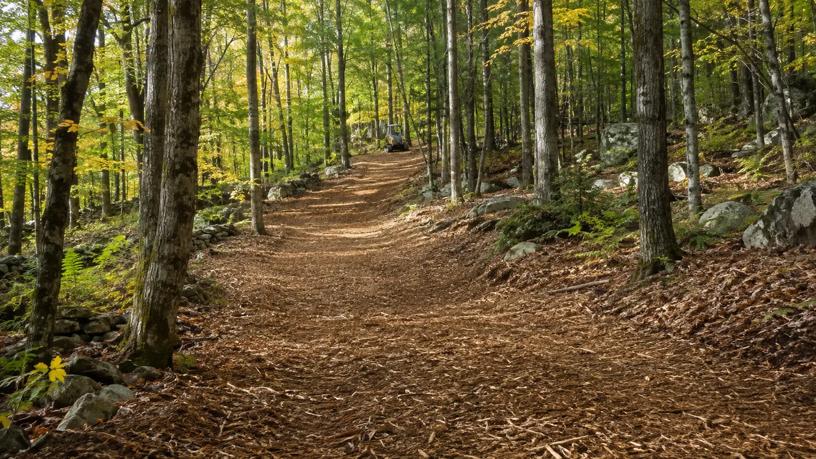
Decide the width and the overhead height first and write them down. Every other trail decision follows from those two numbers.
The expensive mistake: Flagging the route from a map or an aerial rather than by walking it. Aerials do not show wet seeps, ledge, or the fact that the obvious line crosses a drainage three times.
Doing it yourself: Flagging is the part a landowner should do and usually does better than anyone — you know where you want to go and what you want to see. Walk it, flag it, walk it again in a different season, then hand the flags to whoever brings the machine.
Afterwards: A new trail moves water it has never had to handle before. Walk it after the first real rain and again after the spring melt, and fix the two or three places that will otherwise become permanent problems.

Flag the exact corridor, retained vegetation, utilities, walls, fences, structures, downhill exposure, and the width needed for future maintenance.
Old wire, posts, rock, overhead limbs, uncertain boundaries, and public-road authority must be resolved before high-speed production.
For trail & path clearing, write what stays, what goes, how material is handled, where machines may travel, and what the land should support next.
Boundary, easement, utility, road, permit, and owner authorization.
Vegetation, stem size, rock, wetness, debris, grade, and stable access.
Mulch, mow, cut, chip, fell, excavate, haul, or use a sequenced mix.
Finish tolerance, material location, restoration, inspection, and maintenance.
The 3 rules below were read from the agency or the statute on the date shown against each one. Nothing here is a determination for your parcel — the authority named is the one whose answer counts.
50 ft — Vermont, Wetlands
A 50-foot buffer zone runs contiguous to the boundary of every Class II wetland, and most mapped wetlands in Vermont are Class II. Removing vegetation, filling, dredging, ditching, draining or grading inside the wetland or that buffer needs a Vermont Wetland Permit unless it is an Allowed Use under Section 6 of the rules.
Clearing vegetation is explicitly named in the regulated activities, so a mulching pass into a buffer is a permit question even though nothing is being built.
Vermont Wetland Rules; 10 V.S.A. Chapter 37 · Vermont DEC Wetlands Program · checked 2026-09-01 · source
RSA 482-A — New Hampshire, Wetlands
Inside the jurisdictional areas described in RSA 482-A and the Env-Wt administrative rules, a wetlands permit may be required to excavate, fill, dredge, remove material or construct structures.
New Hampshire approvals are separate from Vermont ones. A contractor working across the river holds no standing in either state's process; the landowner is the applicant.
RSA 482-A; NH Code of Administrative Rules Env-Wt 300 · New Hampshire DES Wetlands Bureau · checked 2026-09-01 · source
100 ft — New York, Wetlands
A Freshwater Wetlands Permit is required to drain, dredge, excavate, fill, pollute or erect structures in a regulated wetland or within the 100-foot adjacent area around it. DEC currently regulates freshwater wetlands over 12.4 acres (5 hectares).
The size threshold drops to 7.4 acres on 1 January 2028, which will bring wetlands that are outside jurisdiction today inside it. DEC also states that its maps are a screening tool, not a final determination — a mapped absence is not permission.
Article 24, Environmental Conservation Law (Freshwater Wetlands Act) · New York State DEC · checked 2026-09-01 · source
A compact tracked machine sized to the corridor width, plus overhead pruning and hand work at the pinch points. New trail corridors, reopened paths, woods roads, recreation loops, farm access, and inspection routes. On a trail & Path Clearing job the scope should name the marked work limit, the retained vegetation, how material is handled, and the finish standard — those four decide the price far more than the acreage does.
4–8 inches within the corridor; anything larger is usually felled and routed around instead. That number is the single most useful thing to establish before anyone quotes trail & Path Clearing, because it decides which machine comes and how many passes the work takes.
A planning range of 300–1,500 linear feet per day at a 6–10 foot corridor width. Trail production is linear, not areal, and the variable is what the route crosses. Open woods with no drainage crossings runs at the top of that range; a route that has to be located as it goes, around wet ground and ledge, runs at the bottom. This is a production screen, not a quote or a commitment to a schedule.
A compact tracked machine sized to the corridor width, plus overhead pruning and hand work at the pinch points. Machine choice on a trail & Path Clearing job follows the access route and the ground condition as much as the vegetation — a carrier that suits the work is no use if it cannot reach it.
A corridor opened to a stated width and overhead clearance; A route that follows the terrain rather than a straight line on a map; Turning radius adequate for whatever will actually use it; Pinch points widened and the worst low branches taken out. Anything beyond that list on a trail & Path Clearing project belongs in a separate, separately-priced scope.
Drainage. Clearing a corridor does not solve water and often concentrates it.; Surfacing, grading or hardening; Stream and wetland crossings, which are separate permitted work. Every one of those is a real and common expectation, which is why trail & Path Clearing proposals should state them as exclusions rather than leaving them to be discovered at turnover.
Late autumn and winter. Leaves off makes the route visible, frozen ground protects the tread you are about to create, and you can see the drainage lines the trail must respect.
Wet spring, when a machine following a route creates the rut that becomes the stream the trail then fights forever.
A new trail moves water it has never had to handle before. Walk it after the first real rain and again after the spring melt, and fix the two or three places that will otherwise become permanent problems.
Corridor width — a 4-foot walking path and a 10-foot equipment lane are different jobs at the same length. Overhead clearance — the vertical requirement often costs more than the horizontal one, because it is hand and boom work. Drainage crossings — each one is a decision and possibly a permit, not a length of trail. Grade — following the contour costs distance; going straight up costs a trail that erodes. Route certainty — a flagged route is production. An unflagged route is exploration priced by the day.
Flagging the route from a map or an aerial rather than by walking it. Aerials do not show wet seeps, ledge, or the fact that the obvious line crosses a drainage three times.
Flagging is the part a landowner should do and usually does better than anyone — you know where you want to go and what you want to see. Walk it, flag it, walk it again in a different season, then hand the flags to whoever brings the machine.
Decide the width and the overhead height first and write them down. Every other trail decision follows from those two numbers.
No. A planning range for trail & Path Clearing is arithmetic on the numbers you entered — it has not seen the access route, the boundary, the wet ground, the rock, or the largest stem. Production alone spans 300–1,500 linear feet per day at a 6–10 foot corridor width before anything else is considered, which is why a site review comes before a price.
It can, and on a trail & Path Clearing job it is settled before the machine is scheduled — decide the width and the overhead height first and write them down. Every other trail decision follows from those two numbers. Class II wetlands carry a 50-foot buffer zone (Vermont Wetland Rules; 10 V.S.A. Chapter 37). Clearing vegetation is explicitly named in the regulated activities, so a mulching pass into a buffer is a permit question even though nothing is being built. Checked against Vermont DEC Wetlands Program on 2026-09-01. Because trail & Path Clearing typically covers 300–1,500 linear feet per day at a 6–10 foot corridor width, a stop part-way through for an approval that was never applied for costs more than the approval would have. The property owner is the applicant; a contractor's estimate is not a determination.
It can, and on a trail & Path Clearing job it is settled before the machine is scheduled — decide the width and the overhead height first and write them down. Every other trail decision follows from those two numbers. Excavating, filling or dredging a wetland needs a state permit (RSA 482-A; NH Code of Administrative Rules Env-Wt 300). New Hampshire approvals are separate from Vermont ones. A contractor working across the river holds no standing in either state's process; the landowner is the applicant. Checked against New Hampshire DES Wetlands Bureau on 2026-09-01. Because trail & Path Clearing typically covers 300–1,500 linear feet per day at a 6–10 foot corridor width, a stop part-way through for an approval that was never applied for costs more than the approval would have. The property owner is the applicant; a contractor's estimate is not a determination.
It can, and on a trail & Path Clearing job it is settled before the machine is scheduled — decide the width and the overhead height first and write them down. Every other trail decision follows from those two numbers. A 100-foot adjacent area is regulated alongside the wetland itself (Article 24, Environmental Conservation Law (Freshwater Wetlands Act)). The size threshold drops to 7.4 acres on 1 January 2028, which will bring wetlands that are outside jurisdiction today inside it. DEC also states that its maps are a screening tool, not a final determination — a mapped absence is not permission. Checked against New York State DEC on 2026-09-01. Because trail & Path Clearing typically covers 300–1,500 linear feet per day at a 6–10 foot corridor width, a stop part-way through for an approval that was never applied for costs more than the approval would have. The property owner is the applicant; a contractor's estimate is not a determination.
Share the location, acreage, density, slope, access, photos, and intended outcome. We’ll turn the idea into a scope that can be evaluated on the property.
Request a site assessment↗Open the cost calculator →