Request a site assessment
Land capability

Right-of-Way & Access Clearing

Vegetation management for access roads, utilities, drainage, inspections, frontage, and maintenance corridors.

Estimate clearing cost
Direct answer

How is a utility or access right-of-way cleared, and who authorises it?

Checked 2026-09-01

Vegetation management for access roads, utilities, drainage, inspections, frontage, and maintenance corridors. Tracked mulcher, boom-mounted heads where the corridor is reached from a road, and traffic-control equipment where the public is present, handling 4–8 inches within the corridor. A planning range of 500–2,500 linear feet per day depending on corridor width and traffic exposure covers most projects — corridor work is linear and fast until traffic control enters the picture, at which point the limiting factor is the traffic plan rather than the vegetation. The best window is late autumn through winter, outside the growing season, when the corridor is visible and public traffic is lighter on rural roads. It finishes a corridor opened to a documented width along a documented easement, but not the authority to be there. Written authorisation comes before mobilisation, always. — those are separate, separately-priced scopes.

In practice

Make infrastructure visible and reachable.

Rights-of-way can involve easements, public-road setbacks, utility ownership, traffic control, underground facilities, and environmental restrictions. Written authorization and utility location come before production.

The scope should state the corridor width, overhead needs, retained trees, debris treatment, traffic or public protection, and maintenance interval.

Best window: Late autumn through winter, outside the growing season, when the corridor is visible and public traffic is lighter on rural roads.

Avoid: Any window where the traffic plan cannot be met. On a right-of-way that constraint outranks every vegetation consideration.

What drives the cost of right-of-way & access clearing
FactorWhat it does to the job
Traffic controlFlaggers, signage and a plan are a real daily cost and sometimes the largest one.
Corridor width and overheadBoth are stated in the easement, and both should be read before quoting.
Utility coordinationWorking near energised lines requires qualified people and clearances.
Access from the roadWhether the machine works from the corridor or reaches in from the shoulder.
DocumentationPhoto records and closeout reporting are usually contractual on this scope.
Right-of-Way & Access Clearing: what it finishes and what it does not
Included in this scopeStatus
A corridor opened to a documented width along a documented easementFinished by this scope
Infrastructure — poles, pedestals, culverts, hydrants, valves — visible and reachableFinished by this scope
Sight distance restored at entries and intersectionsFinished by this scope
A defined maintenance interval instead of a rescue every decadeFinished by this scope
The authority to be there. Written authorisation comes before mobilisation, always.NOT finished — price separately
Utility work of any kindNOT finished — price separately
Ditch reshaping or drainage constructionNOT finished — price separately
Before you call

The one thing worth measuring first

Get the recorded easement and read the width and the permitted uses out of it. That document, not the visible corridor, is the work limit.

The expensive mistake: Assuming the easement width. Easements are recorded documents with specific widths and specific permitted activities, and clearing outside one is a trespass regardless of how obvious the corridor looks.

Doing it yourself: No. Authorisation, traffic control and utility proximity all put this outside landowner scope.

Afterwards: Rights-of-way are the clearest case for a fixed interval. A corridor on a three-year cycle stays a corridor; the same corridor on no cycle becomes a full clearing job again and costs several times as much.

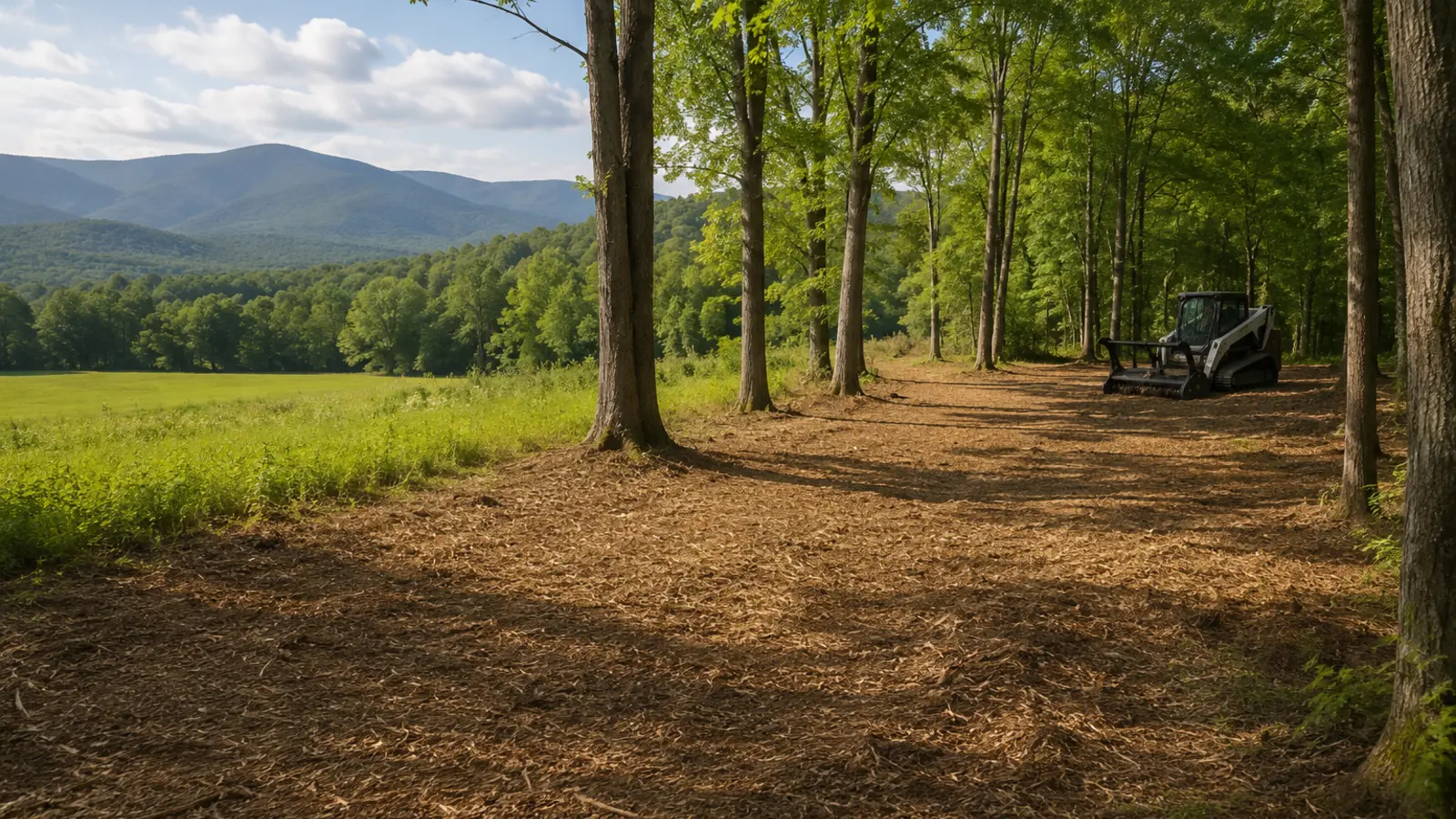
Selective vegetation clearing with retained trees and processed material
Illustrative finish, not a project claim. Actual results follow the marked work limit, vegetation, terrain, soil, access, and written turnover standard.
Field decision

Make authorization and coordination visible

Use a signed map, one owner representative, work-hour limits, traffic or public protection, utility coordination, documentation, and a change-order process.

Separate mobilization, clearing, tree work, excavation, material hauling, erosion control, restoration, and recurring maintenance so responsibility is traceable.

For right-of-way & access clearing, write what stays, what goes, how material is handled, where machines may travel, and what the land should support next.
A four-part project screen
01

Authority

Boundary, easement, utility, road, permit, and owner authorization.

02

Ground

Vegetation, stem size, rock, wetness, debris, grade, and stable access.

03

Method

Mulch, mow, cut, chip, fell, excavate, haul, or use a sequenced mix.

04

Closeout

Finish tolerance, material location, restoration, inspection, and maintenance.

Quote boundaries

Keep adjacent trades out of the gray area.

Define in this scopeUtility and service accessDrainage and culvert visibilityCommercial frontageInspection and equipment routes
Price or verify separatelyTechnical tree work and riggingStump or root excavationGrading, drainage, and soilPermits, traffic control, treatment, or restoration
Verified against the primary source

What the rules say about right-of-way & access clearing

The 2 rules below were read from the agency or the statute on the date shown against each one. Nothing here is a determination for your parcel — the authority named is the one whose answer counts.

One acre of earth disturbance triggers the Construction General Permit

1 acre — Vermont, Stormwater

Construction activity disturbing one acre or more of earth needs coverage under General Permit 3-9020 — and so does a smaller disturbance that is part of a larger common plan of development that will ultimately reach one acre.

Low Risk coverage caps concurrent disturbance at five acres and requires temporary or final stabilization within 14 days of the initial disturbance. Whether a mulching pass counts as "earth disturbance" depends on how much soil is exposed — ask the Stormwater Program before assuming it does not.

General Permit 3-9020 for Stormwater Runoff from Construction Sites · Vermont DEC Stormwater Program · checked 2026-09-01 · source

Class II wetlands carry a 50-foot buffer zone

50 ft — Vermont, Wetlands

A 50-foot buffer zone runs contiguous to the boundary of every Class II wetland, and most mapped wetlands in Vermont are Class II. Removing vegetation, filling, dredging, ditching, draining or grading inside the wetland or that buffer needs a Vermont Wetland Permit unless it is an Allowed Use under Section 6 of the rules.

Clearing vegetation is explicitly named in the regulated activities, so a mulching pass into a buffer is a permit question even though nothing is being built.

Vermont Wetland Rules; 10 V.S.A. Chapter 37 · Vermont DEC Wetlands Program · checked 2026-09-01 · source

Field questions

Know what the machine can—and cannot—solve.

01What does right-of-Way & Access Clearing actually involve?

Tracked mulcher, boom-mounted heads where the corridor is reached from a road, and traffic-control equipment where the public is present. Vegetation management for access roads, utilities, drainage, inspections, frontage, and maintenance corridors. On a right-of-Way & Access Clearing job the scope should name the marked work limit, the retained vegetation, how material is handled, and the finish standard — those four decide the price far more than the acreage does.

02What is the largest stem right-of-Way & Access Clearing can handle?

4–8 inches within the corridor. That number is the single most useful thing to establish before anyone quotes right-of-Way & Access Clearing, because it decides which machine comes and how many passes the work takes.

03How much ground can right-of-Way & Access Clearing cover in a day?

A planning range of 500–2,500 linear feet per day depending on corridor width and traffic exposure. Corridor work is linear and fast until traffic control enters the picture, at which point the limiting factor is the traffic plan rather than the vegetation. This is a production screen, not a quote or a commitment to a schedule.

04What equipment is used for right-of-Way & Access Clearing?

Tracked mulcher, boom-mounted heads where the corridor is reached from a road, and traffic-control equipment where the public is present. Machine choice on a right-of-Way & Access Clearing job follows the access route and the ground condition as much as the vegetation — a carrier that suits the work is no use if it cannot reach it.

05What does right-of-Way & Access Clearing actually finish?

A corridor opened to a documented width along a documented easement; Infrastructure — poles, pedestals, culverts, hydrants, valves — visible and reachable; Sight distance restored at entries and intersections; A defined maintenance interval instead of a rescue every decade. Anything beyond that list on a right-of-Way & Access Clearing project belongs in a separate, separately-priced scope.

06What does right-of-Way & Access Clearing not finish?

The authority to be there. Written authorisation comes before mobilisation, always.; Utility work of any kind; Ditch reshaping or drainage construction. Every one of those is a real and common expectation, which is why right-of-Way & Access Clearing proposals should state them as exclusions rather than leaving them to be discovered at turnover.

07When is the best time of year for right-of-Way & Access Clearing?

Late autumn through winter, outside the growing season, when the corridor is visible and public traffic is lighter on rural roads.

08When should right-of-Way & Access Clearing be avoided?

Any window where the traffic plan cannot be met. On a right-of-way that constraint outranks every vegetation consideration.

09What happens on the property after right-of-Way & Access Clearing is done?

Rights-of-way are the clearest case for a fixed interval. A corridor on a three-year cycle stays a corridor; the same corridor on no cycle becomes a full clearing job again and costs several times as much.

10What drives the cost of right-of-Way & Access Clearing?

Traffic control — flaggers, signage and a plan are a real daily cost and sometimes the largest one. Corridor width and overhead — both are stated in the easement, and both should be read before quoting. Utility coordination — working near energised lines requires qualified people and clearances. Access from the road — whether the machine works from the corridor or reaches in from the shoulder. Documentation — photo records and closeout reporting are usually contractual on this scope.

11What is the most expensive mistake on a right-of-Way & Access Clearing project?

Assuming the easement width. Easements are recorded documents with specific widths and specific permitted activities, and clearing outside one is a trespass regardless of how obvious the corridor looks.

12Can a landowner do right-of-Way & Access Clearing themselves?

No. Authorisation, traffic control and utility proximity all put this outside landowner scope.

13What should I measure before asking about right-of-Way & Access Clearing?

Get the recorded easement and read the width and the permitted uses out of it. That document, not the visible corridor, is the work limit.

14Is an online range for right-of-Way & Access Clearing a quote?

No. A planning range for right-of-Way & Access Clearing is arithmetic on the numbers you entered — it has not seen the access route, the boundary, the wet ground, the rock, or the largest stem. Production alone spans 500–2,500 linear feet per day depending on corridor width and traffic exposure before anything else is considered, which is why a site review comes before a price.

15Does the stormwater rule in Vermont affect right-of-Way & Access Clearing?

It can, and on a right-of-Way & Access Clearing job it is settled before the machine is scheduled — get the recorded easement and read the width and the permitted uses out of it. That document, not the visible corridor, is the work limit. One acre of earth disturbance triggers the Construction General Permit (General Permit 3-9020 for Stormwater Runoff from Construction Sites). Low Risk coverage caps concurrent disturbance at five acres and requires temporary or final stabilization within 14 days of the initial disturbance. Whether a mulching pass counts as "earth disturbance" depends on how much soil is exposed — ask the Stormwater Program before assuming it does not. Checked against Vermont DEC Stormwater Program on 2026-09-01. Because right-of-Way & Access Clearing typically covers 500–2,500 linear feet per day depending on corridor width and traffic exposure, a stop part-way through for an approval that was never applied for costs more than the approval would have. The property owner is the applicant; a contractor's estimate is not a determination.

16Does the wetlands rule in Vermont affect right-of-Way & Access Clearing?

It can, and on a right-of-Way & Access Clearing job it is settled before the machine is scheduled — get the recorded easement and read the width and the permitted uses out of it. That document, not the visible corridor, is the work limit. Class II wetlands carry a 50-foot buffer zone (Vermont Wetland Rules; 10 V.S.A. Chapter 37). Clearing vegetation is explicitly named in the regulated activities, so a mulching pass into a buffer is a permit question even though nothing is being built. Checked against Vermont DEC Wetlands Program on 2026-09-01. Because right-of-Way & Access Clearing typically covers 500–2,500 linear feet per day depending on corridor width and traffic exposure, a stop part-way through for an approval that was never applied for costs more than the approval would have. The property owner is the applicant; a contractor's estimate is not a determination.

Start with the site

Turn right-of-way & access clearing into a marked scope.

Share the location, acreage, density, slope, access, photos, and intended outcome. We’ll turn the idea into a scope that can be evaluated on the property.

Request a site assessmentOpen the cost calculator →