Request a site assessment
Land capability

Pond, Meadow & Field-Edge Reclamation

Selective clearing around upland pond approaches, meadow margins, field edges, and neglected transitions—subject to regulated-area review.

Estimate clearing cost
Direct answer

Can brush be cleared around a pond or wet field edge, and where does the line fall?

Checked 2026-09-01

Selective clearing around upland pond approaches, meadow margins, field edges, and neglected transitions—subject to regulated-area review. Low-ground-pressure tracked machine, working from stable upland ground toward the marked limit, handling 3–6 inches on the upland side of the marked limit. A planning range of 0.3–1 acre per day, or 400–1,500 linear feet of edge covers most projects — edge work is variable ground by definition — wet pockets, stone, old fence and dense cover all sit in the same hundred feet. Production reflects the worst of it, not the average. The best window is firm or frozen ground, which is often the only time the machine can work the edge at all without rutting it. It finishes field and meadow margins pushed back to a defined, maintainable line, but not any work inside a wetland, buffer or protected shoreland without the permit that requires — those are separate, separately-priced scopes.

In practice

Reopen the transition zones where brush steadily consumes usable land.

Edges often contain the most variable conditions on a property: wet ground, stone, old fence, drainage, wildlife cover, and invasive growth. A marked limit prevents a field-reclamation project from drifting into a regulated or intentionally retained buffer.

Work near wetlands, streams, shorelands, or mapped buffers requires confirmation before disturbance. The desired finish should specify whether the edge will be mowed, planted, monitored, or allowed to naturalize in a controlled line.

Best window: Firm or frozen ground, which is often the only time the machine can work the edge at all without rutting it.

Avoid: Wet conditions anywhere near the limit. Rutting on the approach to a regulated feature is exactly the disturbance the rules exist to prevent.

What drives the cost of pond, meadow & field-edge reclamation
FactorWhat it does to the job
Regulated proximityHow close the work gets to a buffer decides the permitting path and sometimes the whole feasibility.
Ground bearingSoft ground can rule out the machine that would otherwise be right.
Edge lengthPriced by the foot at a width, like any corridor.
Hidden materialOld fence, stone and dumping cluster at field edges.
FinishWhether the line will be mowed, planted or allowed to naturalise.
Pond, Meadow & Field-Edge Reclamation: what it finishes and what it does not
Included in this scopeStatus
Field and meadow margins pushed back to a defined, maintainable lineFinished by this scope
Upland pond approaches opened where that is permittedFinished by this scope
The transition between usable ground and retained buffer made visibleFinished by this scope
A line that a mower can hold in future seasonsFinished by this scope
Any work inside a wetland, buffer or protected shoreland without the permit that requiresNOT finished — price separately
Bank stabilisation, dredging or shoreline constructionNOT finished — price separately
A jurisdictional determination — the marked limit comes from the authority, not from the machineNOT finished — price separately
Before you call

The one thing worth measuring first

Locate the regulated boundary in writing, mark it on the ground, and photograph the marks. Everything upland of that line is the job; nothing on the other side of it is.
The expensive mistake: Using a map line as the work boundary. Wetland maps at every level of government are screening tools and every agency involved says so — the boundary that matters is delineated on the ground, and clearing to a map line is how a mulching job becomes an enforcement file.

Doing it yourself: The most useful landowner work here is finding out where the limit actually is, before anyone quotes. That is a phone call and possibly a site visit, and it determines whether the project exists.

Afterwards: Edges regrow faster than open ground because they get light from two sides. An annual pass on the maintained line is what keeps the edge from creeping back in.

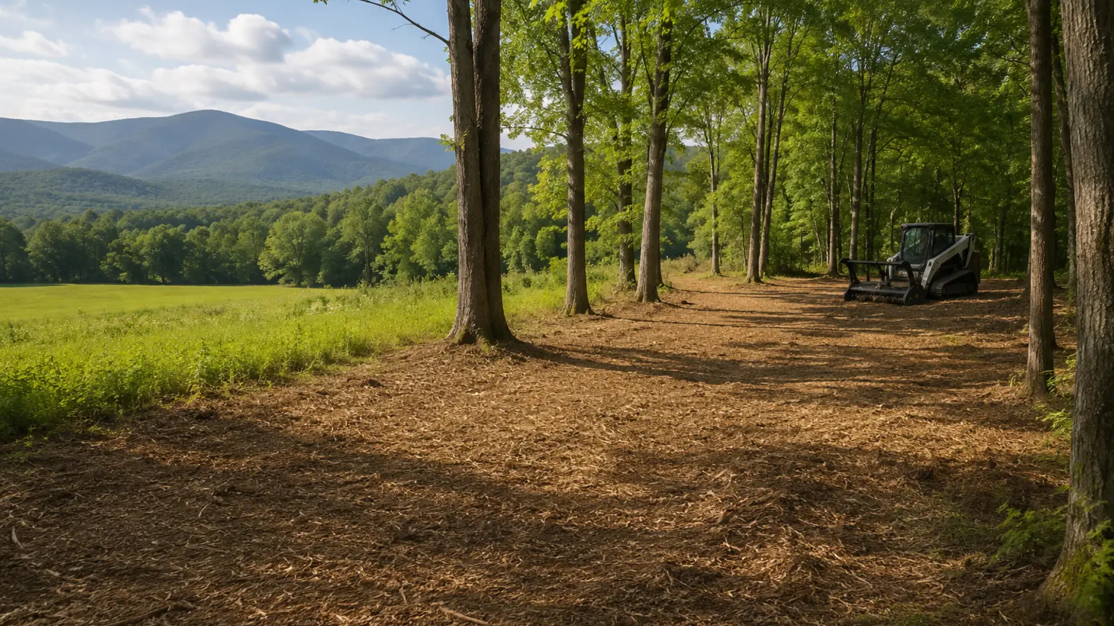
Selective vegetation clearing with retained trees and processed material
Illustrative finish, not a project claim. Actual results follow the marked work limit, vegetation, terrain, soil, access, and written turnover standard.
Field decision

Clear for the next land use

Pasture, orchard, sugarbush, hunting, trail, and farm projects succeed when the clearing width and finish match the next operation.

Coordinate soil, seed, fencing, water, drainage, crop, forestry, or habitat decisions with the appropriate professional after access is restored.

For pond, meadow & field-edge reclamation, write what stays, what goes, how material is handled, where machines may travel, and what the land should support next.
A four-part project screen
01

Authority

Boundary, easement, utility, road, permit, and owner authorization.

02

Ground

Vegetation, stem size, rock, wetness, debris, grade, and stable access.

03

Method

Mulch, mow, cut, chip, fell, excavate, haul, or use a sequenced mix.

04

Closeout

Finish tolerance, material location, restoration, inspection, and maintenance.

Quote boundaries

Keep adjacent trades out of the gray area.

Define in this scopeEncroaching field and meadow edgesUpland pond-access approachesMowable boundary recoveryView and inspection corridors
Price or verify separatelyTechnical tree work and riggingStump or root excavationGrading, drainage, and soilPermits, traffic control, treatment, or restoration
Verified against the primary source

What the rules say about pond, meadow & field-edge reclamation

The 4 rules below were read from the agency or the statute on the date shown against each one. Nothing here is a determination for your parcel — the authority named is the one whose answer counts.

Class II wetlands carry a 50-foot buffer zone

50 ft — Vermont, Wetlands

A 50-foot buffer zone runs contiguous to the boundary of every Class II wetland, and most mapped wetlands in Vermont are Class II. Removing vegetation, filling, dredging, ditching, draining or grading inside the wetland or that buffer needs a Vermont Wetland Permit unless it is an Allowed Use under Section 6 of the rules.

Clearing vegetation is explicitly named in the regulated activities, so a mulching pass into a buffer is a permit question even though nothing is being built.

Vermont Wetland Rules; 10 V.S.A. Chapter 37 · Vermont DEC Wetlands Program · checked 2026-09-01 · source

Shoreland Protection Act reaches 250 feet from mean water level

250 ft — Vermont, Shorelands

The Act regulates land within 250 feet of the mean water level of any lake larger than 10 acres. Creating "cleared area" — removing trees, shrubs or disturbing natural ground cover — needs a permit or a registration, the same as creating impervious surface.

Standards inside the protected shoreland: the site must be on a slope under 20%, no more than 20% of the parcel inside the area may be impervious, and no more than 40% may be cleared area. Registration B covers up to 500 sq ft of new cleared area or impervious surface between 100 and 250 feet from mean water level, if those three standards are met.

10 V.S.A. Chapter 49A, effective 1 July 2014 · Vermont DEC Lakes and Ponds Program · checked 2026-09-01 · source

A 100-foot adjacent area is regulated alongside the wetland itself

100 ft — New York, Wetlands

A Freshwater Wetlands Permit is required to drain, dredge, excavate, fill, pollute or erect structures in a regulated wetland or within the 100-foot adjacent area around it. DEC currently regulates freshwater wetlands over 12.4 acres (5 hectares).

The size threshold drops to 7.4 acres on 1 January 2028, which will bring wetlands that are outside jurisdiction today inside it. DEC also states that its maps are a screening tool, not a final determination — a mapped absence is not permission.

Article 24, Environmental Conservation Law (Freshwater Wetlands Act) · New York State DEC · checked 2026-09-01 · source

Protected shoreland runs 250 feet from the reference line

250 ft — New Hampshire, Shorelands

The Shoreland Water Quality Protection Act establishes protected shoreland within 250 feet of the reference line of public waters, measured horizontally. All fourth-order and greater streams and rivers are covered as well as lakes and ponds. Vegetation removal, excavation, fill and development inside that band are regulated.

Wetlands and shoreland are two separate permits that can overlap. Impacts already covered by a wetlands permit do not need a separate shoreland permit for those same impacts, but any impact inside the protected shoreland that the wetlands permit does not cover still does.

RSA 483-B (Shoreland Water Quality Protection Act) · New Hampshire DES · checked 2026-09-01 · source

Field questions

Know what the machine can—and cannot—solve.

01What does pond, Meadow & Field-Edge Reclamation actually involve?

Low-ground-pressure tracked machine, working from stable upland ground toward the marked limit. Selective clearing around upland pond approaches, meadow margins, field edges, and neglected transitions—subject to regulated-area review. On a pond, Meadow & Field-Edge Reclamation job the scope should name the marked work limit, the retained vegetation, how material is handled, and the finish standard — those four decide the price far more than the acreage does.

02What is the largest stem pond, Meadow & Field-Edge Reclamation can handle?

3–6 inches on the upland side of the marked limit. That number is the single most useful thing to establish before anyone quotes pond, Meadow & Field-Edge Reclamation, because it decides which machine comes and how many passes the work takes.

03How much ground can pond, Meadow & Field-Edge Reclamation cover in a day?

A planning range of 0.3–1 acre per day, or 400–1,500 linear feet of edge. Edge work is variable ground by definition — wet pockets, stone, old fence and dense cover all sit in the same hundred feet. Production reflects the worst of it, not the average. This is a production screen, not a quote or a commitment to a schedule.

04What equipment is used for pond, Meadow & Field-Edge Reclamation?

Low-ground-pressure tracked machine, working from stable upland ground toward the marked limit. Machine choice on a pond, Meadow & Field-Edge Reclamation job follows the access route and the ground condition as much as the vegetation — a carrier that suits the work is no use if it cannot reach it.

05What does pond, Meadow & Field-Edge Reclamation actually finish?

Field and meadow margins pushed back to a defined, maintainable line; Upland pond approaches opened where that is permitted; The transition between usable ground and retained buffer made visible; A line that a mower can hold in future seasons. Anything beyond that list on a pond, Meadow & Field-Edge Reclamation project belongs in a separate, separately-priced scope.

06What does pond, Meadow & Field-Edge Reclamation not finish?

Any work inside a wetland, buffer or protected shoreland without the permit that requires; Bank stabilisation, dredging or shoreline construction; A jurisdictional determination — the marked limit comes from the authority, not from the machine. Every one of those is a real and common expectation, which is why pond, Meadow & Field-Edge Reclamation proposals should state them as exclusions rather than leaving them to be discovered at turnover.

07When is the best time of year for pond, Meadow & Field-Edge Reclamation?

Firm or frozen ground, which is often the only time the machine can work the edge at all without rutting it.

08When should pond, Meadow & Field-Edge Reclamation be avoided?

Wet conditions anywhere near the limit. Rutting on the approach to a regulated feature is exactly the disturbance the rules exist to prevent.

09What happens on the property after pond, Meadow & Field-Edge Reclamation is done?

Edges regrow faster than open ground because they get light from two sides. An annual pass on the maintained line is what keeps the edge from creeping back in.

10What drives the cost of pond, Meadow & Field-Edge Reclamation?

Regulated proximity — how close the work gets to a buffer decides the permitting path and sometimes the whole feasibility. Ground bearing — soft ground can rule out the machine that would otherwise be right. Edge length — priced by the foot at a width, like any corridor. Hidden material — old fence, stone and dumping cluster at field edges. Finish — whether the line will be mowed, planted or allowed to naturalise.

11What is the most expensive mistake on a pond, Meadow & Field-Edge Reclamation project?

Using a map line as the work boundary. Wetland maps at every level of government are screening tools and every agency involved says so — the boundary that matters is delineated on the ground, and clearing to a map line is how a mulching job becomes an enforcement file.

12Can a landowner do pond, Meadow & Field-Edge Reclamation themselves?

The most useful landowner work here is finding out where the limit actually is, before anyone quotes. That is a phone call and possibly a site visit, and it determines whether the project exists.

13What should I measure before asking about pond, Meadow & Field-Edge Reclamation?

Locate the regulated boundary in writing, mark it on the ground, and photograph the marks. Everything upland of that line is the job; nothing on the other side of it is.

14Is an online range for pond, Meadow & Field-Edge Reclamation a quote?

No. A planning range for pond, Meadow & Field-Edge Reclamation is arithmetic on the numbers you entered — it has not seen the access route, the boundary, the wet ground, the rock, or the largest stem. Production alone spans 0.3–1 acre per day, or 400–1,500 linear feet of edge before anything else is considered, which is why a site review comes before a price.

15Does the wetlands rule in Vermont affect pond, Meadow & Field-Edge Reclamation?

It can, and on a pond, Meadow & Field-Edge Reclamation job it is settled before the machine is scheduled — locate the regulated boundary in writing, mark it on the ground, and photograph the marks. Everything upland of that line is the job; nothing on the other side of it is. Class II wetlands carry a 50-foot buffer zone (Vermont Wetland Rules; 10 V.S.A. Chapter 37). Clearing vegetation is explicitly named in the regulated activities, so a mulching pass into a buffer is a permit question even though nothing is being built. Checked against Vermont DEC Wetlands Program on 2026-09-01. Because pond, Meadow & Field-Edge Reclamation typically covers 0.3–1 acre per day, or 400–1,500 linear feet of edge, a stop part-way through for an approval that was never applied for costs more than the approval would have. The property owner is the applicant; a contractor's estimate is not a determination.

16Does the shorelands rule in Vermont affect pond, Meadow & Field-Edge Reclamation?

It can, and on a pond, Meadow & Field-Edge Reclamation job it is settled before the machine is scheduled — locate the regulated boundary in writing, mark it on the ground, and photograph the marks. Everything upland of that line is the job; nothing on the other side of it is. Shoreland Protection Act reaches 250 feet from mean water level (10 V.S.A. Chapter 49A, effective 1 July 2014). Standards inside the protected shoreland: the site must be on a slope under 20%, no more than 20% of the parcel inside the area may be impervious, and no more than 40% may be cleared area. Registration B covers up to 500 sq ft of new cleared area or impervious surface between 100 and 250 feet from mean water level, if those three standards are met. Checked against Vermont DEC Lakes and Ponds Program on 2026-09-01. Because pond, Meadow & Field-Edge Reclamation typically covers 0.3–1 acre per day, or 400–1,500 linear feet of edge, a stop part-way through for an approval that was never applied for costs more than the approval would have. The property owner is the applicant; a contractor's estimate is not a determination.

17Does the wetlands rule in New York affect pond, Meadow & Field-Edge Reclamation?

It can, and on a pond, Meadow & Field-Edge Reclamation job it is settled before the machine is scheduled — locate the regulated boundary in writing, mark it on the ground, and photograph the marks. Everything upland of that line is the job; nothing on the other side of it is. A 100-foot adjacent area is regulated alongside the wetland itself (Article 24, Environmental Conservation Law (Freshwater Wetlands Act)). The size threshold drops to 7.4 acres on 1 January 2028, which will bring wetlands that are outside jurisdiction today inside it. DEC also states that its maps are a screening tool, not a final determination — a mapped absence is not permission. Checked against New York State DEC on 2026-09-01. Because pond, Meadow & Field-Edge Reclamation typically covers 0.3–1 acre per day, or 400–1,500 linear feet of edge, a stop part-way through for an approval that was never applied for costs more than the approval would have. The property owner is the applicant; a contractor's estimate is not a determination.

18Does the shorelands rule in New Hampshire affect pond, Meadow & Field-Edge Reclamation?

It can, and on a pond, Meadow & Field-Edge Reclamation job it is settled before the machine is scheduled — locate the regulated boundary in writing, mark it on the ground, and photograph the marks. Everything upland of that line is the job; nothing on the other side of it is. Protected shoreland runs 250 feet from the reference line (RSA 483-B (Shoreland Water Quality Protection Act)). Wetlands and shoreland are two separate permits that can overlap. Impacts already covered by a wetlands permit do not need a separate shoreland permit for those same impacts, but any impact inside the protected shoreland that the wetlands permit does not cover still does. Checked against New Hampshire DES on 2026-09-01. Because pond, Meadow & Field-Edge Reclamation typically covers 0.3–1 acre per day, or 400–1,500 linear feet of edge, a stop part-way through for an approval that was never applied for costs more than the approval would have. The property owner is the applicant; a contractor's estimate is not a determination.

Start with the site

Turn pond, meadow & field-edge reclamation into a marked scope.

Share the location, acreage, density, slope, access, photos, and intended outcome. We’ll turn the idea into a scope that can be evaluated on the property.

Request a site assessmentOpen the cost calculator →