Request a site assessment
Land capability

Hunting-Land & Habitat Access

Trail, lane, field-edge, inspection-route, and selective vegetation work for recreation and habitat-management properties.

Estimate clearing cost
Direct answer

How should trails and openings be cleared on a hunting or habitat property?

Checked 2026-09-01

Trail, lane, field-edge, inspection-route, and selective vegetation work for recreation and habitat-management properties. Compact tracked mulcher sized to the trail width, with hand work for edge feathering, handling 4–8 inches in the corridors; selective elsewhere by design. A planning range of 400–1,500 linear feet of trail per day, or 0.3–1 acre for openings covers most projects — habitat work is deliberately partial, so the rate reflects how much is actually being touched rather than the parcel size. Most of a habitat project is decisions about what stays. The best window is late winter and very early spring, well before nesting, and far enough ahead of the season that the property settles. It finishes access routes opened to stands, boundaries and cameras, but not food-plot soil preparation, liming or seeding — those are separate, separately-priced scopes.

In practice

Open routes, edges, and management access while retaining useful cover.

Clearing for recreation and habitat should be selective. The goal may be better access, edge feathering, a maintained opening, or equipment passage—not maximum clearing.

Wildlife objectives, nesting seasons, forestry plans, wetlands, food-plot soil work, and long-term mowing should be coordinated with appropriate land-management professionals where they apply.

Best window: Late winter and very early spring, well before nesting, and far enough ahead of the season that the property settles.

Avoid: Nesting season on ground being managed for birds, and the weeks immediately before the season you are managing for — disturbance has a cost.

What drives the cost of hunting-land & habitat access
FactorWhat it does to the job
Route lengthHabitat work is priced mostly by linear feet of access.
SelectivityEdge feathering and retained cover are slower than a clean corridor.
Opening size and numberSeveral small openings cost more than one large one of the same total area.
Terrain and remotenessHabitat parcels are frequently the least accessible ground someone owns.
Current Use planIf the parcel is enrolled, the plan governs what cutting is permitted at all.
Hunting-Land & Habitat Access: what it finishes and what it does not
Included in this scopeStatus
Access routes opened to stands, boundaries and camerasFinished by this scope
Field openings and food-plot areas resetFinished by this scope
Edges feathered rather than cut hard, where that is the goalFinished by this scope
Cover deliberately retained in the places it mattersFinished by this scope
Food-plot soil preparation, liming or seedingNOT finished — price separately
A wildlife management plan, which is a biologist's or forester's workNOT finished — price separately
Any clearing beyond the marked routes and openingsNOT finished — price separately
Before you call

The one thing worth measuring first

Mark the routes and openings on an aerial before anything is cut, and check the total against the property's forest management plan if it is enrolled in Current Use.
The expensive mistake: Clearing too much. The property that gets cleared hardest usually holds the least, because cover and edge are the habitat — and if the parcel is in Current Use, cutting outside the management plan is a tax event as well as a habitat one.

Doing it yourself: Route flagging, camera lanes and small openings with hand tools are genuinely landowner work, and the landowner knows the property better than anyone hired to look at it.

Afterwards: Openings close in fast because they are the sunniest ground on the property. A short annual mow keeps an opening an opening; three years off and it is young forest.

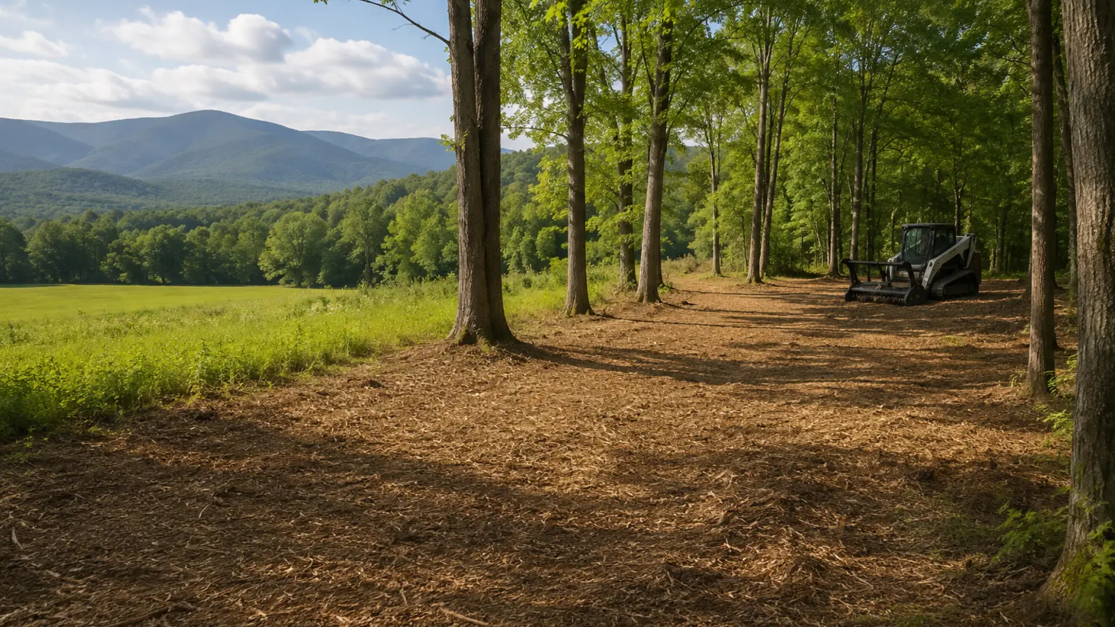
Selective vegetation clearing with retained trees and processed material
Illustrative finish, not a project claim. Actual results follow the marked work limit, vegetation, terrain, soil, access, and written turnover standard.
Field decision

Clear for the next land use

Pasture, orchard, sugarbush, hunting, trail, and farm projects succeed when the clearing width and finish match the next operation.

Coordinate soil, seed, fencing, water, drainage, crop, forestry, or habitat decisions with the appropriate professional after access is restored.

For hunting-land & habitat access, write what stays, what goes, how material is handled, where machines may travel, and what the land should support next.
A four-part project screen
01

Authority

Boundary, easement, utility, road, permit, and owner authorization.

02

Ground

Vegetation, stem size, rock, wetness, debris, grade, and stable access.

03

Method

Mulch, mow, cut, chip, fell, excavate, haul, or use a sequenced mix.

04

Closeout

Finish tolerance, material location, restoration, inspection, and maintenance.

Quote boundaries

Keep adjacent trades out of the gray area.

Define in this scopeHunting and recreation trailsField and opening accessBoundary and camera routesHabitat-project preparation
Price or verify separatelyTechnical tree work and riggingStump or root excavationGrading, drainage, and soilPermits, traffic control, treatment, or restoration
Verified against the primary source

What the rules say about hunting-land & habitat access

The 2 rules below were read from the agency or the statute on the date shown against each one. Nothing here is a determination for your parcel — the authority named is the one whose answer counts.

Class II wetlands carry a 50-foot buffer zone

50 ft — Vermont, Wetlands

A 50-foot buffer zone runs contiguous to the boundary of every Class II wetland, and most mapped wetlands in Vermont are Class II. Removing vegetation, filling, dredging, ditching, draining or grading inside the wetland or that buffer needs a Vermont Wetland Permit unless it is an Allowed Use under Section 6 of the rules.

Clearing vegetation is explicitly named in the regulated activities, so a mulching pass into a buffer is a permit question even though nothing is being built.

Vermont Wetland Rules; 10 V.S.A. Chapter 37 · Vermont DEC Wetlands Program · checked 2026-09-01 · source

Clearing enrolled land can trigger the Land Use Change Tax

10% or 20% of FMV — Vermont, Property tax

Land in the Use Value Appraisal ("Current Use") program is taxed on its farm or forest use rather than market value. Developing it triggers a Land Use Change Tax of 10% or 20% of the fair market value of the developed portion, and for eligible forest land that obligation is perpetual.

The definition of "development" is the part that catches clearing projects: it includes construction of a building, road or structure, mining, excavation or landfill — and also cutting timber contrary to the property's forest or conservation management plan or the minimum acceptable standards for forest management. A clearing pass that a plan does not authorise is a tax event, not only a forestry one. More than 16,000 forestland parcels totalling over 2 million acres were enrolled as of 2026, so on Vermont acreage this is a likely question rather than an edge case.

32 V.S.A. Chapter 124 (Use Value Appraisal) · Vermont Department of Taxes / Department of Forests, Parks and Recreation · checked 2026-09-01 · source

Field questions

Know what the machine can—and cannot—solve.

01What does hunting-Land & Habitat Access actually involve?

Compact tracked mulcher sized to the trail width, with hand work for edge feathering. Trail, lane, field-edge, inspection-route, and selective vegetation work for recreation and habitat-management properties. On a hunting-Land & Habitat Access job the scope should name the marked work limit, the retained vegetation, how material is handled, and the finish standard — those four decide the price far more than the acreage does.

02What is the largest stem hunting-Land & Habitat Access can handle?

4–8 inches in the corridors; selective elsewhere by design. That number is the single most useful thing to establish before anyone quotes hunting-Land & Habitat Access, because it decides which machine comes and how many passes the work takes.

03How much ground can hunting-Land & Habitat Access cover in a day?

A planning range of 400–1,500 linear feet of trail per day, or 0.3–1 acre for openings. Habitat work is deliberately partial, so the rate reflects how much is actually being touched rather than the parcel size. Most of a habitat project is decisions about what stays. This is a production screen, not a quote or a commitment to a schedule.

04What equipment is used for hunting-Land & Habitat Access?

Compact tracked mulcher sized to the trail width, with hand work for edge feathering. Machine choice on a hunting-Land & Habitat Access job follows the access route and the ground condition as much as the vegetation — a carrier that suits the work is no use if it cannot reach it.

05What does hunting-Land & Habitat Access actually finish?

Access routes opened to stands, boundaries and cameras; Field openings and food-plot areas reset; Edges feathered rather than cut hard, where that is the goal; Cover deliberately retained in the places it matters. Anything beyond that list on a hunting-Land & Habitat Access project belongs in a separate, separately-priced scope.

06What does hunting-Land & Habitat Access not finish?

Food-plot soil preparation, liming or seeding; A wildlife management plan, which is a biologist's or forester's work; Any clearing beyond the marked routes and openings. Every one of those is a real and common expectation, which is why hunting-Land & Habitat Access proposals should state them as exclusions rather than leaving them to be discovered at turnover.

07When is the best time of year for hunting-Land & Habitat Access?

Late winter and very early spring, well before nesting, and far enough ahead of the season that the property settles.

08When should hunting-Land & Habitat Access be avoided?

Nesting season on ground being managed for birds, and the weeks immediately before the season you are managing for — disturbance has a cost.

09What happens on the property after hunting-Land & Habitat Access is done?

Openings close in fast because they are the sunniest ground on the property. A short annual mow keeps an opening an opening; three years off and it is young forest.

10What drives the cost of hunting-Land & Habitat Access?

Route length — habitat work is priced mostly by linear feet of access. Selectivity — edge feathering and retained cover are slower than a clean corridor. Opening size and number — several small openings cost more than one large one of the same total area. Terrain and remoteness — habitat parcels are frequently the least accessible ground someone owns. Current Use plan — if the parcel is enrolled, the plan governs what cutting is permitted at all.

11What is the most expensive mistake on a hunting-Land & Habitat Access project?

Clearing too much. The property that gets cleared hardest usually holds the least, because cover and edge are the habitat — and if the parcel is in Current Use, cutting outside the management plan is a tax event as well as a habitat one.

12Can a landowner do hunting-Land & Habitat Access themselves?

Route flagging, camera lanes and small openings with hand tools are genuinely landowner work, and the landowner knows the property better than anyone hired to look at it.

13What should I measure before asking about hunting-Land & Habitat Access?

Mark the routes and openings on an aerial before anything is cut, and check the total against the property's forest management plan if it is enrolled in Current Use.

14Is an online range for hunting-Land & Habitat Access a quote?

No. A planning range for hunting-Land & Habitat Access is arithmetic on the numbers you entered — it has not seen the access route, the boundary, the wet ground, the rock, or the largest stem. Production alone spans 400–1,500 linear feet of trail per day, or 0.3–1 acre for openings before anything else is considered, which is why a site review comes before a price.

15Does the wetlands rule in Vermont affect hunting-Land & Habitat Access?

It can, and on a hunting-Land & Habitat Access job it is settled before the machine is scheduled — mark the routes and openings on an aerial before anything is cut, and check the total against the property's forest management plan if it is enrolled in Current Use. Class II wetlands carry a 50-foot buffer zone (Vermont Wetland Rules; 10 V.S.A. Chapter 37). Clearing vegetation is explicitly named in the regulated activities, so a mulching pass into a buffer is a permit question even though nothing is being built. Checked against Vermont DEC Wetlands Program on 2026-09-01. Because hunting-Land & Habitat Access typically covers 400–1,500 linear feet of trail per day, or 0.3–1 acre for openings, a stop part-way through for an approval that was never applied for costs more than the approval would have. The property owner is the applicant; a contractor's estimate is not a determination.

16Does the property tax rule in Vermont affect hunting-Land & Habitat Access?

It can, and on a hunting-Land & Habitat Access job it is settled before the machine is scheduled — mark the routes and openings on an aerial before anything is cut, and check the total against the property's forest management plan if it is enrolled in Current Use. Clearing enrolled land can trigger the Land Use Change Tax (32 V.S.A. Chapter 124 (Use Value Appraisal)). The definition of "development" is the part that catches clearing projects: it includes construction of a building, road or structure, mining, excavation or landfill — and also cutting timber contrary to the property's forest or conservation management plan or the minimum acceptable standards for forest management. A clearing pass that a plan does not authorise is a tax event, not only a forestry one. More than 16,000 forestland parcels totalling over 2 million acres were enrolled as of 2026, so on Vermont acreage this is a likely question rather than an edge case. Checked against Vermont Department of Taxes / Department of Forests, Parks and Recreation on 2026-09-01. Because hunting-Land & Habitat Access typically covers 400–1,500 linear feet of trail per day, or 0.3–1 acre for openings, a stop part-way through for an approval that was never applied for costs more than the approval would have. The property owner is the applicant; a contractor's estimate is not a determination.

Start with the site

Turn hunting-land & habitat access into a marked scope.

Share the location, acreage, density, slope, access, photos, and intended outcome. We’ll turn the idea into a scope that can be evaluated on the property.

Request a site assessmentOpen the cost calculator →